I was recently asked to write an article for Social Practices Art Network, created by artist, researcher, and creative director of Portable City Projects, Jules Rochielle. The site serves as a resource for individuals, organizations, community groups and institutions that are interested in “new genre art forms” and practices. The site currently features a few other Canadian artists, including an interview with Justin Langlois of Broken City Lab in Windsor ON.
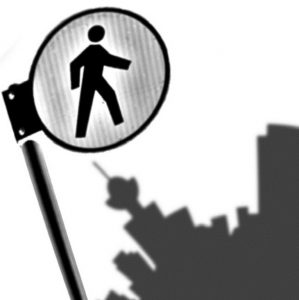
Let your mind wander. Close your eyes and trace your routes through the city. Which streets, paths and laneways do you travel most often? What’s your favourite street to walk along, park to pause in, row of houses to walk past? Which landmarks do you identify first?
Rooted in the theories and practices of Guy Debord, Gaston Bachelard, Kevin Lynch and Jane Jacobs, Pedestrian City encourages the exploration of a neighbourhood or city through memory. It engages participants with elements of psychogeography, reflexivity, reverie and story-telling, evoking a sense of nostalgia and collective memory by representing routes through the city on hand-drawn maps, otherwise known as memory maps.
Memory maps enable us to revisit and represent experiences and impressions of our cities. They invite us to contribute to the collective memory of neighbourhoods, contextualizing them through the exploration of spatial memories and associations. The maps are a tool to make connections between the places we go and interactions we experience while walking. They show the relationship between everyday experience and how we choose our routes through the city, helping to connect the things we’ve noticed but maybe never put together in the same mental space.
The beginnings of Pedestrian City took a meandering path that included studying concepts and practices of urban planning, gentrification, public space and pedestrianism. The project initially highlighted an investigation that brought together several individual experiences of walking in the Trinity Bellwoods neighbourhood in Toronto, in the context of everyday life and routine, and what works and doesn’t work for pedestrians in an urban setting.
Outside of studying a particular neighbourhood, the broader aim of the project was, and continues to be, to introduce people to the concept and practice of psychogeography – to guide them to move through the city with a heightened awareness of how the environment affects them; their chosen paths, moods, the evocation of memories and feelings of nostalgia – all while offering an opportunity to examine a specific neighbourhood or issue through a more critical lens.
Since moving to Vancouver in May 2009, Pedestrian City has expanded as a practice, engaging participants in a number of memory mapping exercises. A preliminary green mapping project was undertaken with the Vancouver Public Space Network, a short lecture was presented at VIVO Media Arts Centre during the Olympics, and a psychogeographic Jane’s Walk took place in Cambie Village in 2010.
More recently, I have been engaged in dialogue with a local teacher about introducing Pedestrian City to high school students as an element of their sustainability curriculum, and participated in the student organized Plan-It Earth Youth Forum in April 2011. In collaboration with HASTE, I spent two days in June leading grade 5 students in a memory mapping exercise and critical discussion about their routes to school. I also presented a memory mapping workshop at Sustainable Cities, as part of the training sessions for their Youth-Led Development interns.