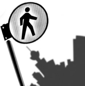
Q. Describe Pedestrian City, your involvement and the resources needed to execute it.
Pedestrian City began in 2006 as my final masters project. Influenced by Kevin Lynch, Jane Jacobs, Rebecca Solnit, Gaston Bachelard, Michel de Certeau, Guy Debord and the Situationist International, I wanted to find a way to apply all of this theory in a fun and creative way. So instead of writing a thesis I decided to engage people in the exploration and documentation of a neighbourhood as a way to understand on a more personal and conscious level what factors determine the routes people take and how they construct mental maps of the city.
Since moving to Vancouver the project has evolved into more than just a collection of personal narratives of a Toronto neighbourhood. I’ve collected maps on three different themes, one of which is in collaboration with the VPSN. I’ve also created a website and blog that provide resources relevant to pedestrianism and urban sustainability, advocating for more walkable neighbourhoods.
I engage people in the practice of psychogeography to create a series of visual narratives of the city. This offers a way for people to contribute to the collective memory of neighbourhoods and contextualize them through the exploration of spatial memories and associations, and how these relate to how we choose our routes through the city. Ultimately, I like to think of it as a public engagement tool that enables people to connect the dots between the spaces, places and interactions they experience on a daily basis. Things they notice but may not readily put together in the same mental space. It’s also an opportunity to highlight both contested and celebrated spaces in the city.
Q. What is a memory map?
Through our daily activities and routines we construct an assortment of memory maps that include routes to school or work, paths to friend’s houses, a favourite space to walk or place to pause, and all of the details in between. When we move away from conventional maps our maps become much more interesting and personalized. Ask two people to draw a map of the same neighbourhood and watch how each person will have a different perception of their surroundings; indicating different points of interest and valued features.
The collection of memory maps was influenced by Kevin Lynch’s book The Image of the City, in which he examines what details are important when orienting oneself within a city and choosing routes to traverse it. There are numerous factors at play in addition to the physical layout of streets and buildings. Memory, smell, time of day, noise, aesthetics, and perceived threats all influence the paths we take. Memory maps are a fast and easy way to get a sense of what works and doesn’t work for pedestrians in an urban setting.
Q. What was the general reception and feedback of other people? How did the community absorb it?
The reception over the last year has been overwhelmingly positive! While the project is still in its infancy in many ways, I think there is a lot of potential to grow and take on new collaborations and initiatives.
Q. What were the major challenges?
The major challenge was being bold enough to approach people and make Pedestrian City public. I had been fairly complacent about it while living in Toronto, feeling like it was something I would want to develop beyond my school work someday, but there wasn’t a lot of interest from anyone I had approached. As soon as I moved to Vancouver, even before, people here were encouraging me to make it into something bigger. There’s been a lot of support and interest – so I guess the biggest challenge was finding the right city and community to take the project to the next level.
Q. What value(s) drive your work? Why is this work important?
I value liveable, walkable, connected cities and communities where people can feel safe to use active forms of transportation, becoming more familiar with the subtle details of their neighbourhoods in the process. Collectively we consume too much, drive too much and generally have a disconnect from larger environmental issues. If I can encourage people to walk more (or bike, skateboard, use transit) it’s a small step in the right direction, a step towards reconnecting at the local level and leaving a lighter footprint on the planet.
Q. What does public space mean to you? Do you have suggestions on how to improve public space in Vancouver and Toronto?
Public space is part of our everyday experience. More than simply sidewalks, streets, parks and squares we move through, these are spaces where we eat, play, socialize rest and reflect. Healthy and inviting public spaces are important to foster inclusive and safe communities – more than merely existing, they need to be interesting enough to draw passers-by in. We need places to stay, not just spaces to pass through. Vancouver and Toronto both have some great public spaces and urban parks. My biggest criticism is the amount of priority given to accommodating the automobile. But even this is beginning to change.
For example, Toronto recently designated two car-free zones on the Ryerson and UofT campuses – a small step in the right direction. As for Vancouver, there has recently been a lot of emphasis on increasing cycling infrastructure and temporary car-free zones throughout the summer. However, I would like to see car-free zones year-round. The Olympics were a good indication of people’s ability to change travel patterns and adapt to using more active forms of transportation.
